Published on August 30, 2023

5 must-see German rivers

With well over 4,000 miles of interconnected rivers, canals, streams and lakes, Germany boasts one of the most developed inland navigation systems in the world. German rivers such as the Rhine work as key arteries for agricultural and industrial regions, irrigating entire valleys and facilitating the transport of goods and materials. Water in Germany is also an essential source of hydroelectric power. And, throughout history, German rivers have served as natural borders separating regions, countries and empires.
Beyond such pragmatic considerations, Germany’s rivers are a source of beauty that inspires artists and attracts millions of tourists each year. They have even contributed to the names of many German cities.. So, get on board and let’s take a tour along five of the most important rivers in Germany.
With a total length of 1,777 miles, the Danube is the second-longest river in Europe, after the Volga in Russia. It’s also the river that passes through the highest number of countries in the world (ten!). From its source in Germany’s Black Forest, the Danube winds its way through Austria, Slovakia, Hungary, Croatia, Serbia, Romania, Bulgaria, Moldova and Ukraine before finally flowing into the Black Sea. But the Danube isn’t merely famous for breaking records; it also provides water to more than 20 million people.
The Danube is a major tourist attraction. Each year, millions of people cruise on its waters and enjoy the beautiful scenery and historical wonders it offers, from Roman remains to Regensburg, the best-preserved medieval city in Germany. In 1866, the Austrian composer Johann Strauss II gave the river international fame by composing “An der schönen blauen Donau” (“By the Beautiful Blue Danube”), a waltz more commonly known under the English title of “The Blue Danube.”
Springing from the Giant Mountains in the Czech Republic, the Elbe runs through Bohemia before crossing into Germany. It then flows through the western and eastern parts of the country, before ending up in the North Sea at the port of Hamburg.
The 678-mile Elbe has played an important part in the history of Europe, dating as far back as the Roman Empire. In the Middle Ages, it marked the eastern limit of Charlemagne’s empire. More recently, from the construction of the Berlin Wall in 1961 to its dismantling in 1989, the river served as a natural inner border between East Germany and West Germany. It is even said that the remains of Adolf Hitler were scattered in the river.
Nowadays, the German section of the Elbe is famous for its pretty vistas, from tiny wine villages to the German city of Dresden in Saxony, which is also known as Elbflorenz (Florence on the Elbe).
If you consider the Weser and the Werra to be two separate rivers, then the Main holds the title of the longest river flowing only within Germany. Running through 326 miles, it starts in northeastern Bavaria, flows through central Germany and drains into the Rhine by Rüsselheim in Hesse, near the cities of Mainz and Wiesbaden. It plays an important strategic role, especially thanks to the 2,200-mile-long Main-Danube Canal, which connects the Main with the Danube and the Rhine rivers and enables the barge transportation of freight from the North Sea to the Black Sea.
The Main runs along its fair share of beautiful and historical sights, such as the romantic old town of Bamberg, the Roman camp of Marktbreit and the bustling city of Frankfurt am Main. If you prefer to stay on the ground, the 372-mile Mainradweg cycling route will take you through the beautiful regions of Franconia and Hesse, all the way up to the city of Mainz.
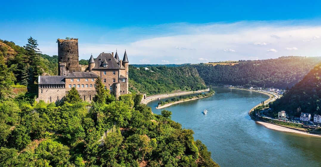
Running for 764 miles, the Rhine is the second-longest river that flows into Germany from south to north. From its source in Switzerland, it crosses several countries. As such, it plays a strategic role as a natural border between Switzerland and three of its neighbors (Austria, Liechtenstein and Germany), as well as between France and Germany. Once it crosses into Germany, the Rhine continues its picturesque journey through deep gorges and valleys filled with fairytale-like German castles and vineyards. Finally, it crosses the Netherlands and flows into the North Sea.
But the Rhine is much more than a tourist attraction at the heart of Western Europe. Thanks to its remarkably powerful current, it’s the busiest river on the continent. Heavy-loaded barges use this important route to connect several industrial centers and provide them with crucial materials and products.
The Weser originates at the confluence of the Werra and the Fulda, by the town of Hannoversch Münden (often shortened to Hann. Münden) in Lower Saxony. It continues through the North German Plain, where it connects to the canal network. Finally, it ends up in the North Sea, near the ports of Bremerhaven and Nordenham. Combined with the Werra, the Weser has a total length of 462 miles, making it the longest river that flows solely within Germany.
Like the Rhine, the Weser is a major German attraction. It offers picture-perfect views of the numerous villages along the well-named Deutsche Märchenstraße (German Fairy Tale Road), many of which inspired Brothers Grimm’s fairy tales.
While there are many more worth a look at, the five German rivers in our list embody the diversity and importance of waterways in Germany. Throughout history, they have played a crucial role in the development of the countries they cross, both by forming natural borders and by enabling economic and cross-cultural exchanges. Come test the waters and see by yourself!